A map of the world in Jesus’ time [video]
Posted by staff / December 17, 2015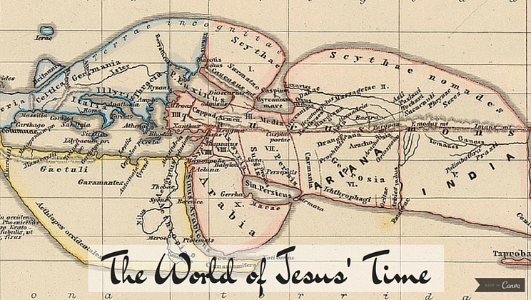
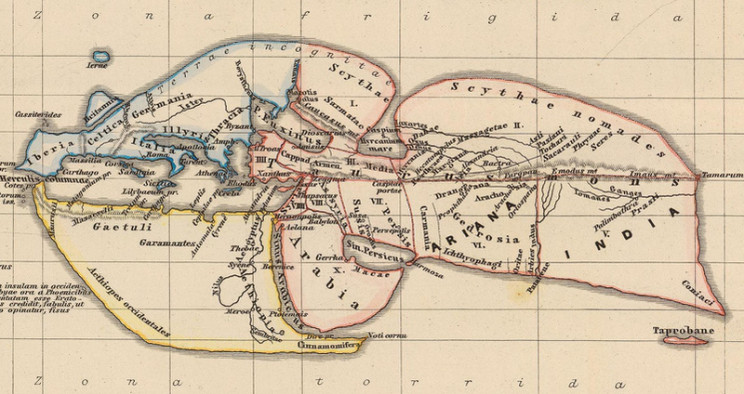
This time of year, the center of the world for many is Bethlehem, at least the Bethlehem of 2000 years ago. It’s even more interesting to note, then, that the most learned geographer of the time also saw it as right smack in the middle of everything, even if its full significance had yet to be realized.
Strabo, born around 64 B.C. on the edge of the Roman Empire, received a classical Greek education due to his family’s elite status and did an impressive amount of traveling for his day. Though it might seem surprising, he correctly identified that the Earth had cold poles, temperate regions, and a “torrid” band smack in the middle, even if the only land masses he knew of extended as far as India, Ethiopia, Britain, and scant knowledge of what are today the Scandinavian countries. Even China, with a larger population than the Roman Empire itself, remained a mystery.
To get back to the central point, so to speak, Palestine made the map, though its significance lay in being a bridge to Egypt.
Strabo’s account also includes some history of the Jewish people. He explains how “an Egyptian priest named Moses” led a group of followers who believed that God is “one thing which encompasses us all” to the place where Jerusalem now stood. Strabo continues:
“He easily obtained possession of it, as the spot was not such as to excite jealousy, nor for which there could be any fierce contention; for it is rocky, and, although well supplied with water, it is surrounded by a barren and waterless territory.”
Well, he might have been the best geographer of his time, but as for political science predictions, he missed the boat big time.
Full story at Atlas Obscura.
Graphics credit: Canva


Comments are off for this post.